Microsoft Flight Simulator mods
109,185 results- 15 per page
- 30 per page
- 45 per page
- 60 per page
-
See more per page
Bigger pages, fewer clicks - and no ads anywhere.
Go Pro
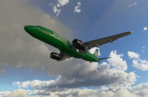
Boston Celtics
Explore the iconic Boston Celtics livery in this New England sports team-themed add-on. Relive the glory days of legendary players like Bird, McHale, Parish, and Ainge from the 80s. Simply unzip the file and add it to your community folder for a seamless integration into your simulator experience.
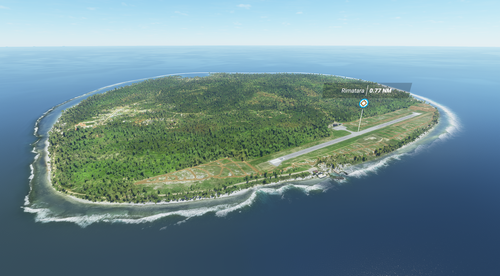
Rimatara Island (French Polynesia)
Explore the westernmost inhabited island in French Polynesia with this mod for Microsoft Flight Simulator. Rimatara Island features a land area of 8.6 km² and a population of 872. Combine with NTAM Rimatara Airport for an enhanced experience.
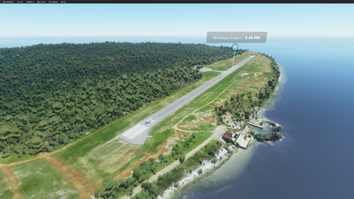
NTAM Rimatara Airport (French Polynesia)
Explore the missing NTAM Rimatara Airport in French Polynesia with this add-on for Microsoft Flight Simulator 2020. This airport is a part of the Maupiti Islands Aerial mod, enhancing your flying experience in the region. Support the creator through donations if you enjoy the scenery and airport details.
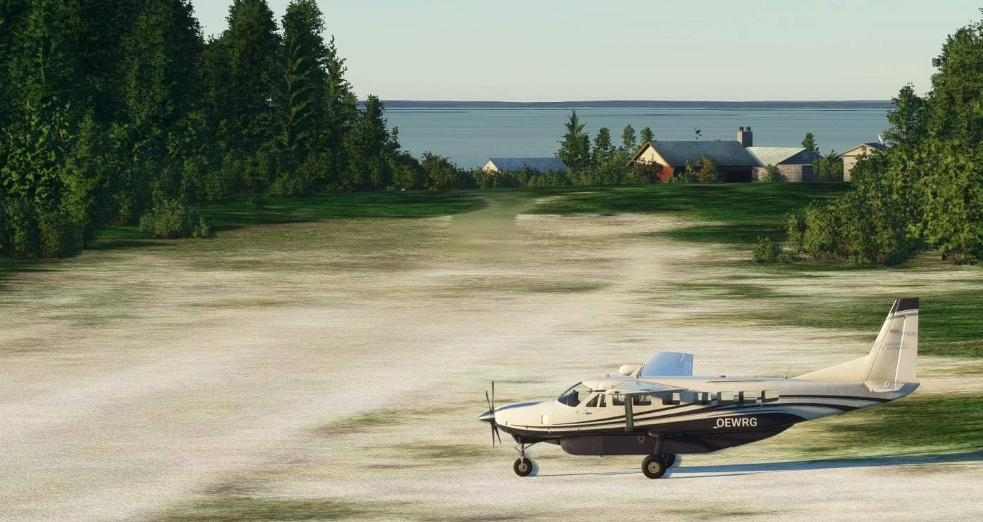
CJN7 – Little Churchill River / Dunlop’s Fly-in Lodge v1.0
Little Churchill River/Dunlop’s Fly-in Lodge Airport is a small airport in Manitoba, Canada to get to Lake Waskaiowaka for fishing and canoeing. Lake Waskaiowaka is missing from MSFS, so this scenery is required for the airport to work. The lake has some graphicsal issues, which I hope to fix soon. The airport itself is there in MSFS, but it does not have a parking spot or the dock. I have added all those things and a little extra (rocks, terraform and the whole lake). GPS Coordinates: 56.57999999999613, -96.24750000000000 MSFS 2020 Airports 11 Oct, 2020 MSFS 2020 Airports 9 Nov, 2020 MSFS 2020 Airports 16 Sep, 2021
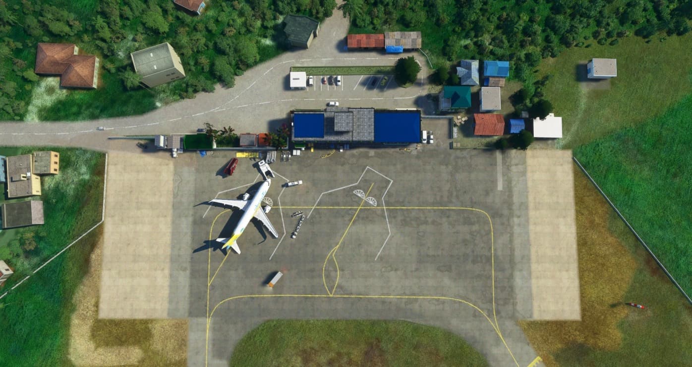
Virac Airport – RPUV v1.0
I had the amazing pleasure to work with the awesome TurtleTank1997! So here it is folks, a handcrafted Virac Airport! Virac Airport is the only airport serving Catanduanes and is classified as a major domestic airport. It has commercial flights to and from manila using Cebu Pacific and to my knowledge, used to have PAL express as well. This airport contains a mix of handcrafted and default assets in order to blend it in to MSFS’s environment. Thanks so much to TurtleTank1997 for beautifully modelling and texturing these amazing objects! *DISCLAIMER* – Scenery is loosely based on google maps satellite imagery and may not be 100% accurate to the real life location. – Virac does not have ATC in real life. GPS Coordinates: 13.580563846638347, 124.21204106137614 MSFS 2020 Airports 3 Dec, 2020 MSFS 2020 Airports 7 Apr, 2022 MSFS 2020 Airports 13 Sep, 2021
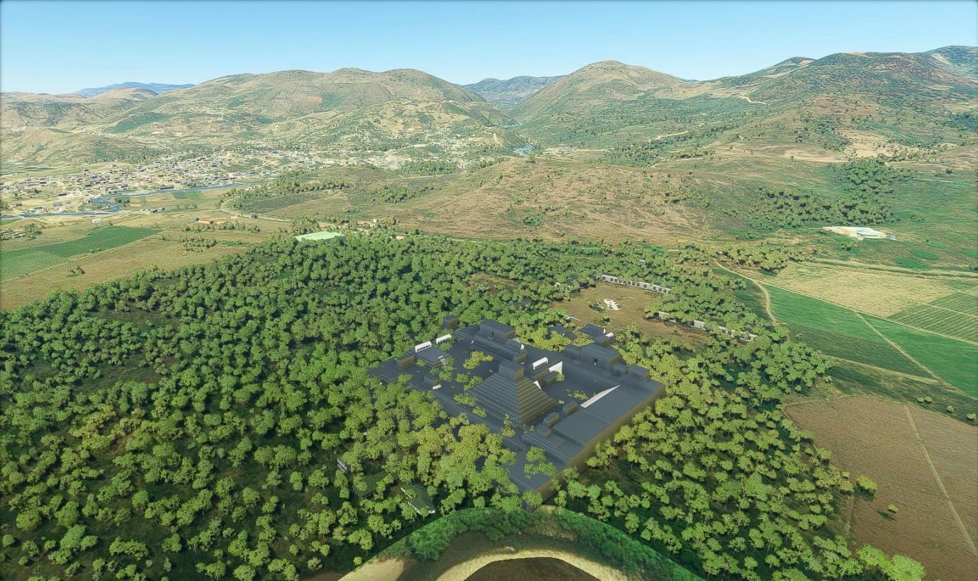
Copan Ruinas Acropolis v1.0
“Copán is an archaeological site of the Maya civilization in the Copán Department of western Honduras. This ancient Maya city mirrors the beauty of the physical landscape in which it flourished—a fertile, well-watered mountain valley in western Honduras at an elevation of 600 meters (2,400 feet) above mean sea level. It was the capital city of a major Classic period kingdom from the 5th to 9th centuries AD.” (taken from Wikipedia). GPS Coordinates: 14.839313, -89.1412485 MSFS 2020 Scenery 11 Oct, 2020 MSFS 2020 Scenery 30 Sep, 2021 MSFS 2020 Scenery 3 Jun, 2021
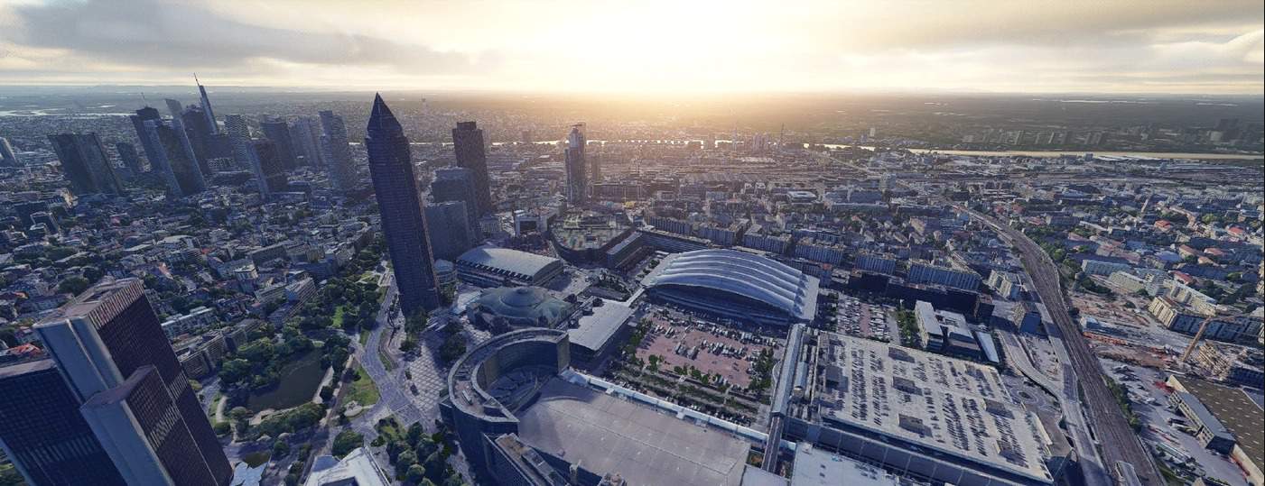
Frankfurt,Germany v1.0
Frankfurt Germany. MSFS 2020 Scenery 31 Oct, 2020 MSFS 2020 Scenery 21 Feb, 2021 MSFS 2020 Scenery 31 Oct, 2020

Kielce – Masłów Airport – EPKA v1.0
Kielce – Masłów Airport (EPKA) is VFR aerodrome recommended for small General Aviation Aircrafts based near to the Kielce City in Świętokrzyskie Mountains in Poland. Fall in love with polish landscapes flying Cessna C152 from EPKA airport. Install: put “epka” folder into your community folder GPS Coordinates: 50.899642, 20.728616 MSFS 2020 Airports 1 Jan, 2021 MSFS 2020 Airports 30 Jan, 2021 MSFS 2020 Airports 5 Nov, 2020
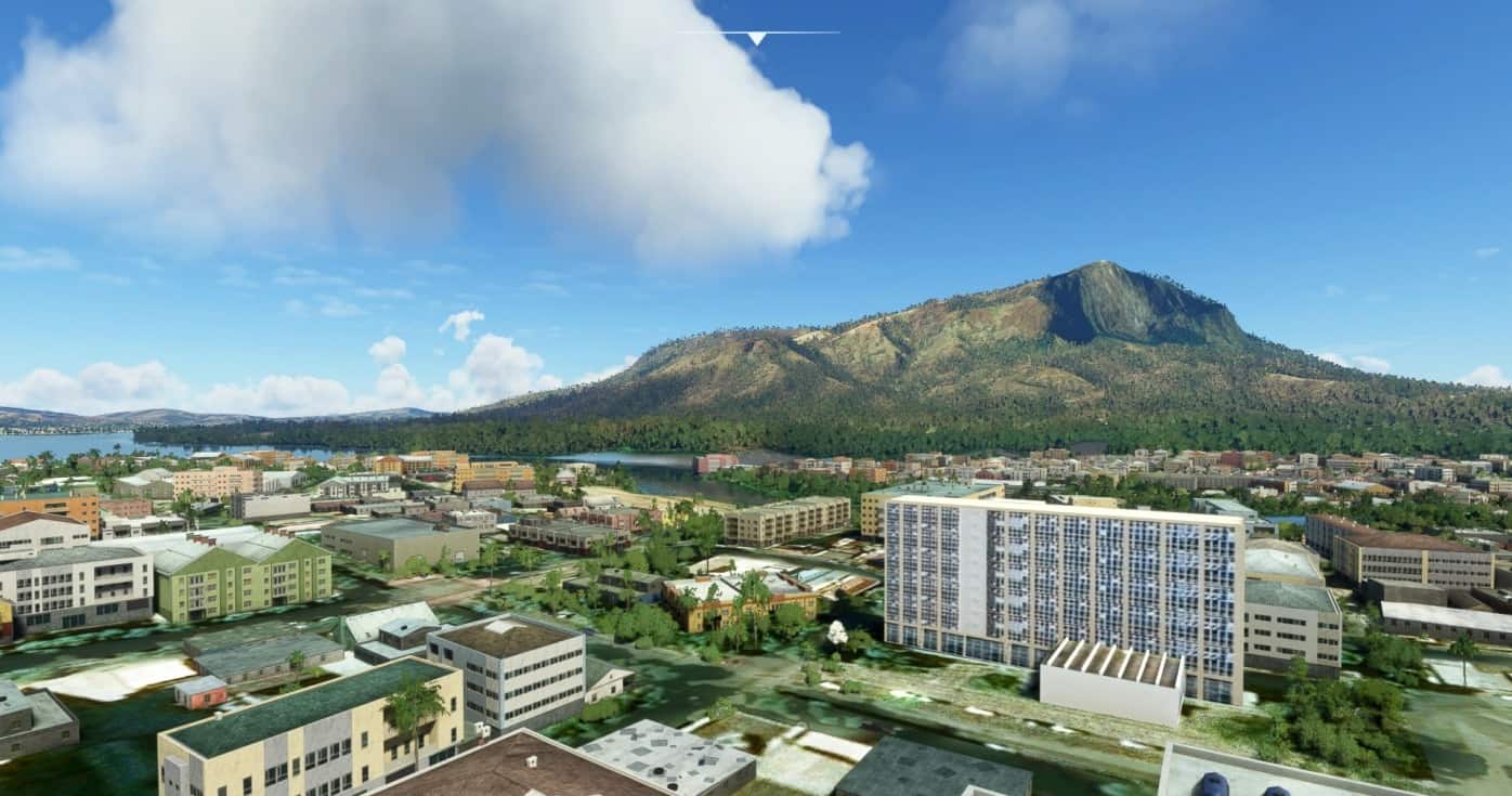
SBGV – Aeroporto Coronel Altino Machado de Oliveira – Governador Valadares v1.1
Governador Valadares is a Brazilian municipality in the countryside of Minas Gerais. In 2018, its population was 278,685 inhabitants, thus being the ninth most populated city in the state. [1] It is an economical axis of the middle valley of the Doce River (Rio Doce, lit. “Sweet river”), having a significant influence on the east and northeast portion of Minas Gerais and local authorities of the state of Espírito Santo. Governador Valadares sits on the bank of the Doce River (Rio Doce), 324 km from Belo Horizonte. Governador Valadares has an area of about 2 342 km², being only 58 km² of urban area. The discovery of the city started at the beginning of the XVI century, that explored the Doce River searching for precious metals. The settlement began between the XVIII and XIX centuries, constructing barracks destined to keep an eye at the Amerindians, who used to attack the settlers and merchants. With the construction of the EFVM (Vitória-Minas Railway), in 1907, the settlements were consolidated. The growth of the population and commercial development was improved due to the location of the city, that was near to coffee farms and wood extraction fields. The municipality was emancipated from Peçanha in the 1930s. After the 40s, the extraction of precious metals brought a notable population growth, along with livestock and commerce. But with the decline of natural resources, the money could only be earned through the investment of immigrants, who would later go to other countries. Commerce is the most important source of income in the city, along with agribusiness and regional manufactured products. Installation: copy the folder to the Community folder GPS Coordinates: -18.8972517, -41.9862878 MSFS 2020 Airports 23 Oct, 2020 MSFS 2020 Airports 16 Oct, 2020 MSFS 2020 Airports 29 Nov, 2020
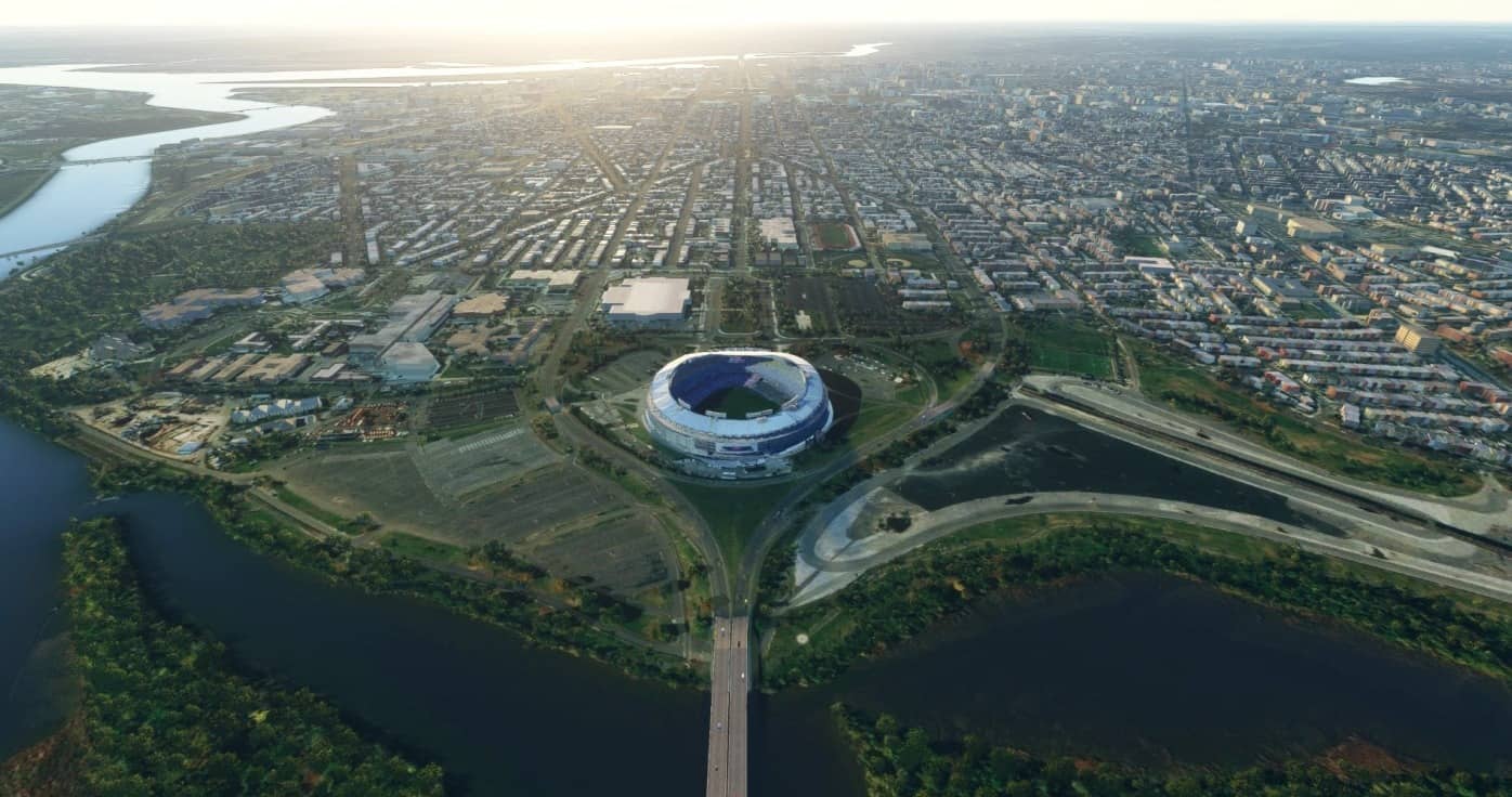
RFK Stadium, Washington, DC v1.0
RFK Stadium, Washington, DC Google Maps> RenderDoc> Blender> MSFS Imagry can be dated by the Iphone 6 ad on the river side Inline with the Lincoln Memorial, Washington Monument, and the US Capitol on the Anacostia River, RFK Stadium opened in 1961 as District of Columbia Stadium with a capacity of 49,219. RFK has been home to 1 NFL team, 1 USFL team, 2 MLB teams, 5 Professional Soccer teams, and 2 College Football teams. Teams include The Washington Football team, Washington Senators, Washington Nationals, and DC United. Installed by pasting folder into Community Folder GPS Coordinates: 38.88902627860611, -76.97259969854693 MSFS 2020 Scenery 13 Dec, 2020 MSFS 2020 Scenery 15 Feb, 2021 MSFS 2020 Scenery 21 Oct, 2020
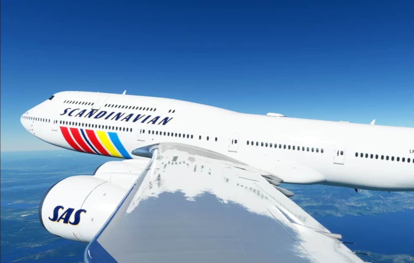
SAS / RETRO / 747-8 v1.0
This is a livery beased on SAS 747-200, LN-AEO “IVAR VIKING” This is only the left side of the plane. I will of course fix the fault when Asobo or some else provide a file that i can use. Hope you like it! Enjoy! MSFS 2020 Liveries 16 Apr, 2022 MSFS 2020 Liveries 7 Nov, 2022 MSFS 2020 Liveries 19 Dec, 2020
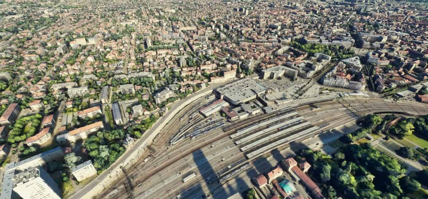
Dijon city and suburbs v1.0
Work in progress scenery. Include LFSD airport (visual only for now) In development : – Improve LFSD airport quality, – Improve border render, – Improve altitude differences and shifts beetween some LOD’s pattern. Addon history: v1.0: initial release Installation: Extract both dijona and dijonb folders into the Community folder GPS Coordinates: 47.3167, 5.0167 MSFS 2020 Scenery 27 Jul, 2021 MSFS 2020 Scenery 19 Oct, 2021 MSFS 2020 Scenery 14 Nov, 2020
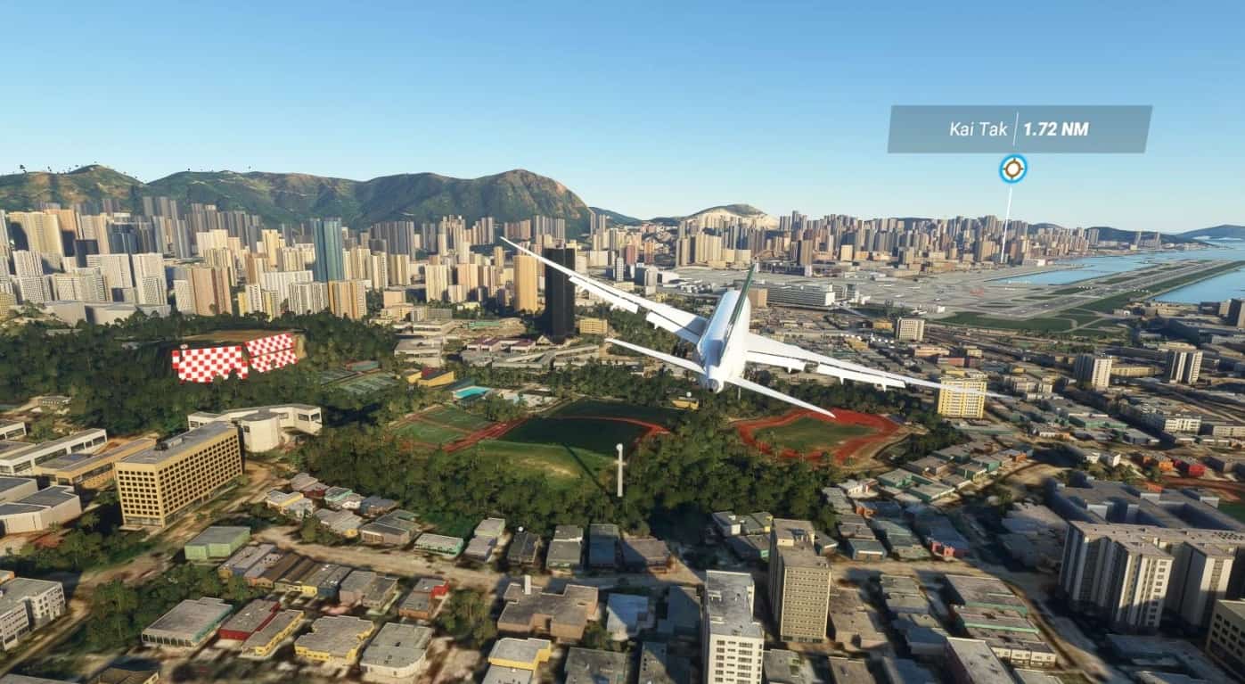
Hong Kong – Kai Tak v1.1
Update 1.1 Small update Cleaned up signs and taxiways that were incorrect Redesignated gates as ramps so that airstairs works Adjusted glideslope on both 13 and 31. Added an exclusion rectangle over where cruise terminal would be to see if that will help those with 3rd party scenery problems (not sure what it does if anything) Removed building from threshold of rwy13 in standard scenery. Hong Kong Kai Tak with the famous rwy 13 approach that closed in 1998 and little remains as of today of the original Airport with much of the site being redeveloped into housing and a cruise terminal. This scenery brings back that challenging approach Install Extract the file ali50-Kaitak from ali501-kaitak.rar Place file into the community folder This is the first Scenery I have ever created for any flight sim and I underestimated the time need and the steep learning curve. Thank you to those who have posted SDK tutorials online as this has being an amazing help. While I am releasing the first version of this scenery it is still very much a working progress. Currently the textures are very basic, and I have not figured out the SID’s and STARS yet although each runway does have and ILS (IGS for rwy13) Runway 13 IGS Frequency 111.90 heading 088 Remember this is a visual approach so disconnect auto pilot before Checkerboard hill Runway 31 ILS Frequency 109.90 I am aware of unwanted ground traffic and lights across the Airport however at the moment i am unable to remove them Things that need improvement 1. SIDS and STARS nav data 2. Custom buildings texture (PBR) 3. Finish Hactl cargo terminal 4. Maintenance area needs hangers modelling 5. Double Jetways 6. Ground markings Plus many other small things GPS Coordinates: 22.322549, 114.202527 MSFS 2020 Airports 2 Oct, 2021 MSFS 2020 Airports 15 Apr, 2021 MSFS 2020 Airports 16 Dec, 2020
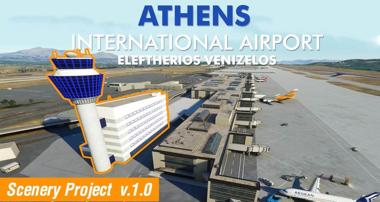
Athens Intl. Airport Eleftherios Venizelos (LGAV) Scenery v1.0
This is an ongoing scenery project of Athens International Airport Eleftherios Venizelos (LGAV) in Greece. It is a work in progress and as such this version includes ONLY the Tower and the adjacent building with high quality textures, emissive glass and functional red beacon lights at night. If you like this project please consider supporting it on Paypal or on buymeacoffee.com! Αν σας αρέσει αυτό το scenery project και οι άλλες μου δημιουργίες, μπορείτε να με υποστηρίξετε μέσω PayPal ή στο buymeacoffee! Installation 1. Unzip file 2. Drag & drop the extracted folder to Community folder 3. Open Microsoft Flight Simulator 2020 Related Content https://www.allflightmods.com/microsoft-flight-simulator-2020/msfs2020-other/goldair-handling-ground-services-vest-and-uniform-v1-0-2/ https://www.allflightmods.com/microsoft-flight-simulator-2020/msfs2020-other/newrest-catering-truck-livery-v1-0/ If you like this project and my other content, feel free to support it and buy me a coffee! Αν σας αρέσει αυτό το scenery project και οι άλλες μου δημιουργίες, μπορείτε να με υποστηρίξετε μέσω PayPal ή στο buymeacoffee! GPS Coordinates: 37.9361459285496, 23.946559511805145 MSFS 2020 Airports 18 Oct, 2020 MSFS 2020 Airports 17 Jul, 2022 MSFS 2020 Airports 16 Dec, 2020
Belo Horizonte Landmarks v1.0
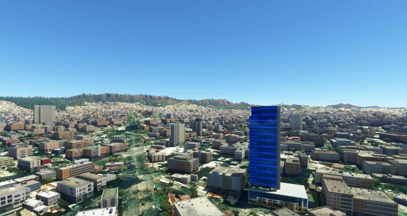
Belo Horizonte is the sixth-largest city in Brazil, with a population around 2.7 million. It is the 13th-largest city in South America and the 18th-largest in the Americas. The metropolis is anchor to the Belo Horizonte metropolitan area, ranked as the third-most populous metropolitan area in Brazil and the 17th-most populous in the Americas. Belo Horizonte is the capital of the state of Minas Gerais, Brazil’s second-most populous state. It is the first planned modern city in Brazil. The region was first settled in the early 18th century, but the city as it is known today was planned and constructed in the 1890s, to replace Ouro Preto as the capital of Minas Gerais. The city features a mixture of contemporary and classical buildings, and is home to several modern Brazilian architectural icons, most notably the Pampulha Complex. In planning the city, Aarão Reis and Francisco Bicalho sought inspiration in the urban planning of Washington, D.C.[2] The city has employed notable programs in urban revitalization and food security, for which it has been awarded international accolades. The city is built on several hills, and is completely surrounded by mountains.[3] There are several large parks in the immediate surroundings of Belo Horizonte. The Mangabeiras Park (Parque das Mangabeiras), 6 km (4 mi) southeast of the city centre in the hills of Curral Ridge (Serra do Curral), has a broad view of the city. It has an area of 2.35 km2 (580 acres), of which 0.9 km2 (220 acres) is covered by the native forest. The Jambeiro Woods (Mata do Jambeiro) nature reserve extends over 912 hectares (2,250 acres), with vegetation typical of the Atlantic Forest. More than 100 species of birds inhabit the reserve, as well as 10 species of mammals. Belo Horizonte was one of the host cities of the 1950 and the 2014 FIFA World Cup. Additionally, the city shared as host of the 2013 FIFA Confederations Cup and the football tournament during the 2016 Summer Olympics. Fly around the city and discover more than 20 famous sites in the city of pão de queijo. Installation: copy the gear simulation folder-belohorizonte-landmarks to the Community folder GPS Coordinates: -19.919146, -43.938623 MSFS 2020 Scenery 3 Apr, 2021 MSFS 2020 Scenery 5 Oct, 2021 MSFS 2020 Scenery 13 Oct, 2020
- 15 per page
- 30 per page
- 45 per page
- 60 per page
-
See more per page
Bigger pages, fewer clicks - and no ads anywhere.
Go Pro