Microsoft Flight Simulator mods
109,300 results- 15 per page
- 30 per page
- 45 per page
- 60 per page
-
See more per page
Bigger pages, fewer clicks - and no ads anywhere.
Go Pro
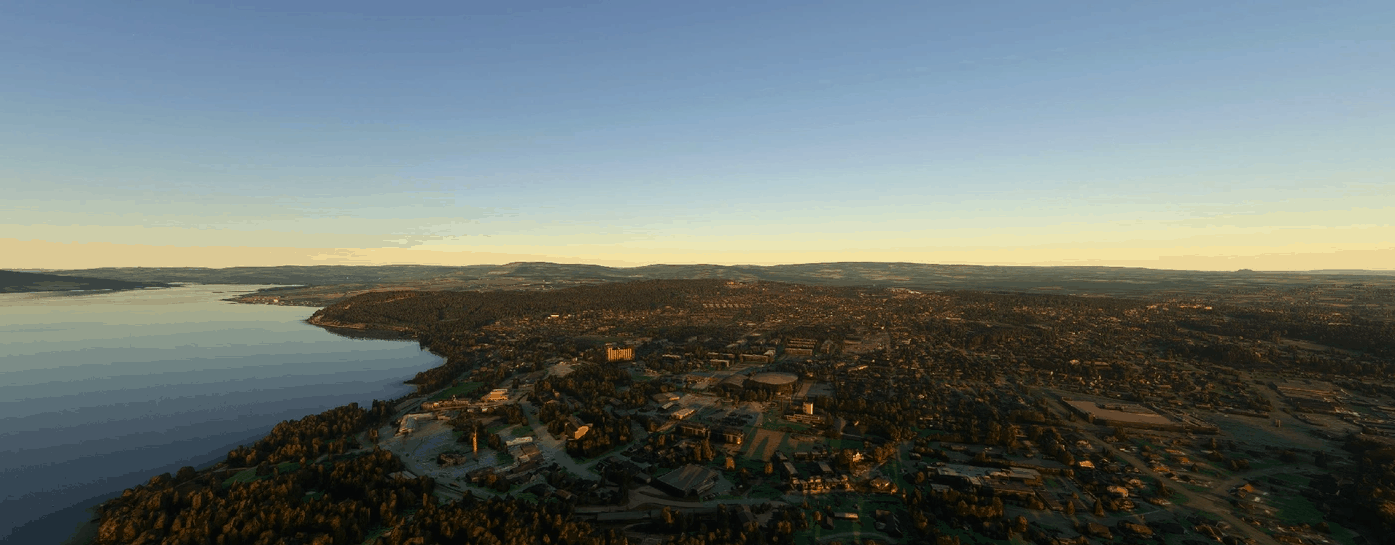
Hamar Photogrammetry Scenery v1.2
Hamar Photogrammetry Scenery This is a photogrammetry scenery for Microsoft Flight Simulator 2020 that covers the City of Hamar in Norway, and some of the adjacent areas. The coverage area extends just north of ENHA Hamar Airport, as far as Kapp to the North-East and Hjellum to the South-East, and to the south as far as to Tokstad. Please see the included coverage map for more exact coverage. This photogrammetry scenery is based on data from Google, which has been carefully color adjusted to match the default scenery, and the height has been adjusted to blend in as well as possible with the default scenery. It has been optimized to be viewed from a distance, in which case it will show a pretty accurate representation of what you’ll see from a real airplane. If you know the area well you should also be able to find most addresses or buildings from “real life”, although up-close the details are somewhat rough. This scenery is optimized to be viewed from an airplane, not from up-close. It should have a minimal to moderate impact on your FPS and performance in general, depending on your hardware and system settings. On a system with an AMD Ryzen 3900X CPU, an Nvidia RTX 2070 Super GPU and MSFS and addon-data on fast NVME SSD’s, with MSFS Graphic settings on a slightly modified “High” setting, it has negligible to no effect on FPS and performance in general, as long as you don’t have too many other photogrammetry sceneries installed. The scenery will be better optimized for performance in a future version. This scenery does not include ENHA Hamar Airport and excludes that area. It will work fine with both the default ENHA airport and any third party replacement airport. Installation: Just Drag & Drop or copy the included directory (cj-scenery-hamar) into your MSFS Community folder. Known issues and limitations: Default roads and some other parts of the default scenery will be visible at certain places, this is because of the way the height of the Google Earth data has been adjusted. I’ve made my best effort to make it blend in as well as possible with the default scenery data, but default roads will be visible at certain places, and default ground scenery will be visible at some locations. None of this is obvious when viewing the scenery from an airplane. Road traffic is limited to where there are default roads, and some erratic road traffic movement might be observed where default roads and Google Earth data intersect. The boundaries of the Google Earth data is visible, although I’ve made an effort to make it blend in as well as possible with the default scenery. The resolution of the Google Earth data is very course when viewed up-close, I emphasize that this scenery is meant to be viewed from an airplane. The scenery has not yet been optimized for performance, this will be done in a future release (clean up the mesh, optimize the texture resolution and “bake” the texture). Tools being used to produce this scenery: MSFS Toolkit Google Earth Decoder Blender Node JS Lily Texture Packer Python & some custom scripts Releases and fixes: Version 0.1.2 – Removed visible “oil spills” in the water (leftovers from the Google Earth water layer) Version 0.1.1 – Merged scenery into one part for easier installation and management Version 0.1.0 – Initial release Copyright Notice: Any individual is permitted to use this scenery for private non-commercial use, but do not re-distribute this scenery or use it for any commercial purpose without a written agreement with the author. GPS Coordinates: 60.798752, 11.068061 MSFS 2020 Scenery 26 Sep, 2020 MSFS 2020 Scenery 13 Apr, 2021 MSFS 2020 Scenery 24 Sep, 2020
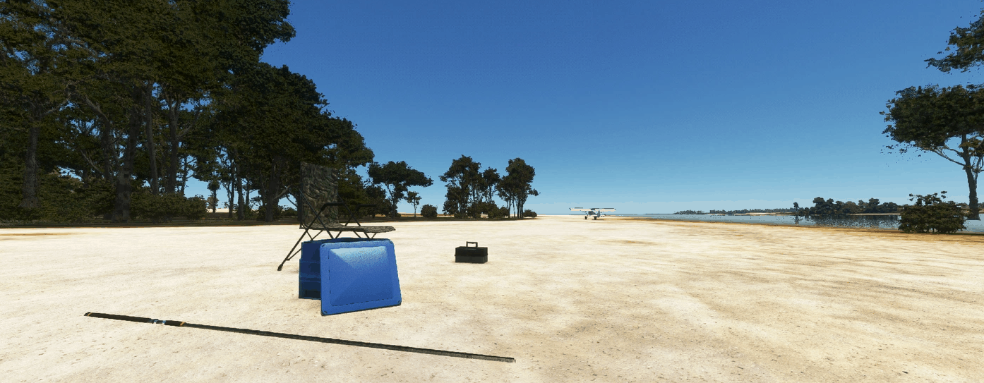
Berkeley River Lodge Airstrip v0.3
Be polite – this is my first try in scenery creation. I created an airstrip in the Australian Western Territories in the Kimberley region. It is a private strip for the Berkeley River Lodge, a luxury refuge at the remote coast. I came upon this strip when I was studying about the mishap of a german pilot who got lost in this very area in 1933: Hans Bertram and his technician Klausmann were flying with their Junkers W-33 called „Atlantis“ from Indonesia to Australia when they lost orientation over water and landed near the Berkeley river mound. They went missing for eight weeks in the wilderness, until they were rescued. Hans Bertram later wrote a book about this adventure (“Flug in die Hölle”, “Flight to Hell”), and in the 80s there was a TV documentary about the mission. There is no ATC, no fuel, no lighting – as in real life. If someone wants to join me in enhancing this strip: you are very welcome! The whole project is under Public Domain. The windsock is artificial – as is the ICAO Code. Things to do: – insert 3d modell of main Lodge building – exchange white cones at runway edge with white half oil barrels GPS Coordinates: -14.337540, 127.772825 MSFS 2020 Airports 18 Dec, 2020 MSFS 2020 Airports 10 Nov, 2021 MSFS 2020 Airports 13 May, 2021
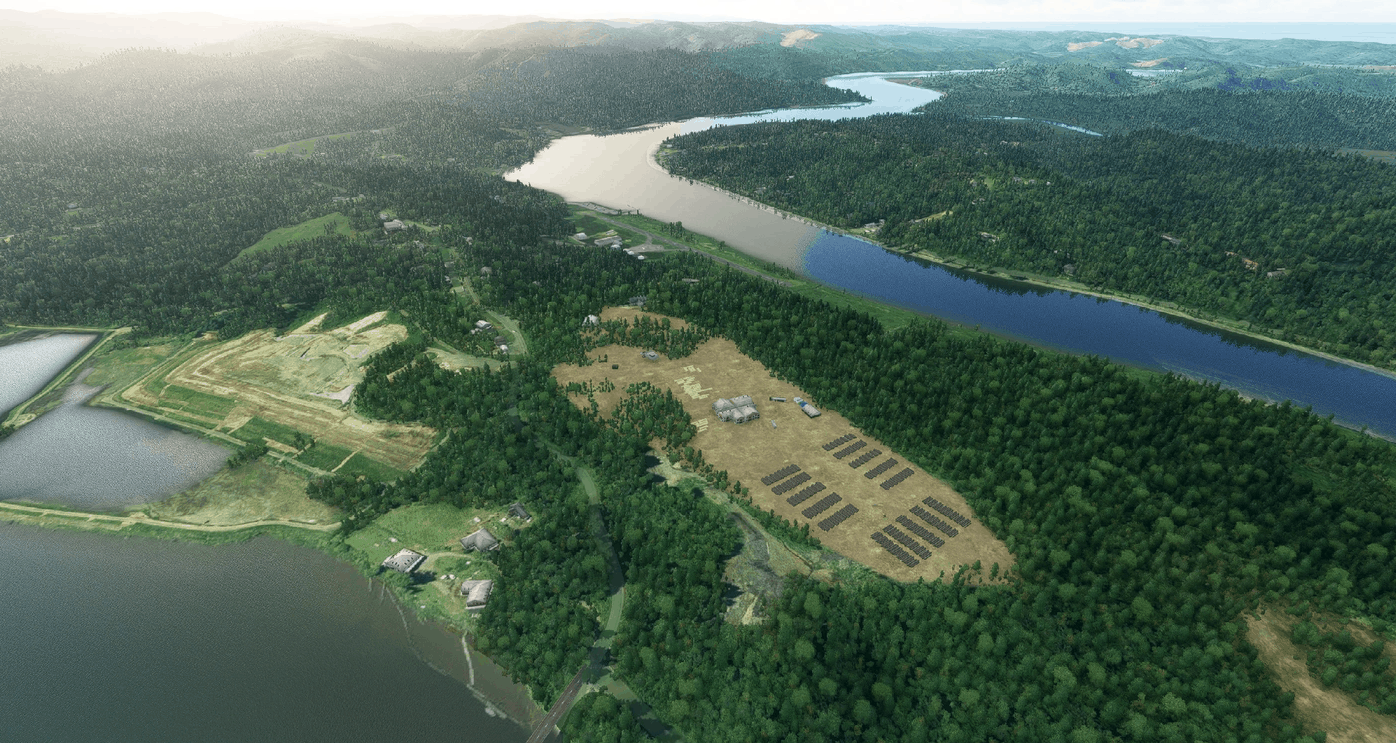
Toledo State (5S4), OR, US v1.0
Toledo is a city located along the Yaquina river in Oregon, US. The airport is a quick hop from Flying M Ranch or Fairways and easy to reach by VOR and VFR navigation using ONP VOR or the Yaquina river. The final approach to this airport is nothing less than fantastic, I suggest to watch some videos in youtube before attempting landing here. The pilot must coast the river at low altitude and be very precise when touching down as the runway is short at 533mt / 1700ft. To make things more interesting there are tall trees on the right side and immediate vicinity of the runway. Other obstacles to negotiate are a nearby parking and small dock. The surroundings of the airport have been carefully modelled and the large industrial complexes have been detailed. I could have added more but it would hit performance. Alltree company logging storage could not be detailed completely (my 3070 was starting to drop FPS), I had to keep that out to ensure that the scenery does not hit performance. Happy banked and short landings. CREDITS – IMPORTANT NOTE – READ CAREFULLY In order for this scenario to work correctly you need to have installed Dave’s 3D People Libbrary by BadMed Many many thanks to BadMed for this precious library. GPS Coordinates: 44.6010278,-123.9396111 MSFS 2020 Airports 20 Nov, 2021 MSFS 2020 Airports 13 Jun, 2021 MSFS 2020 Airports 23 May, 2021
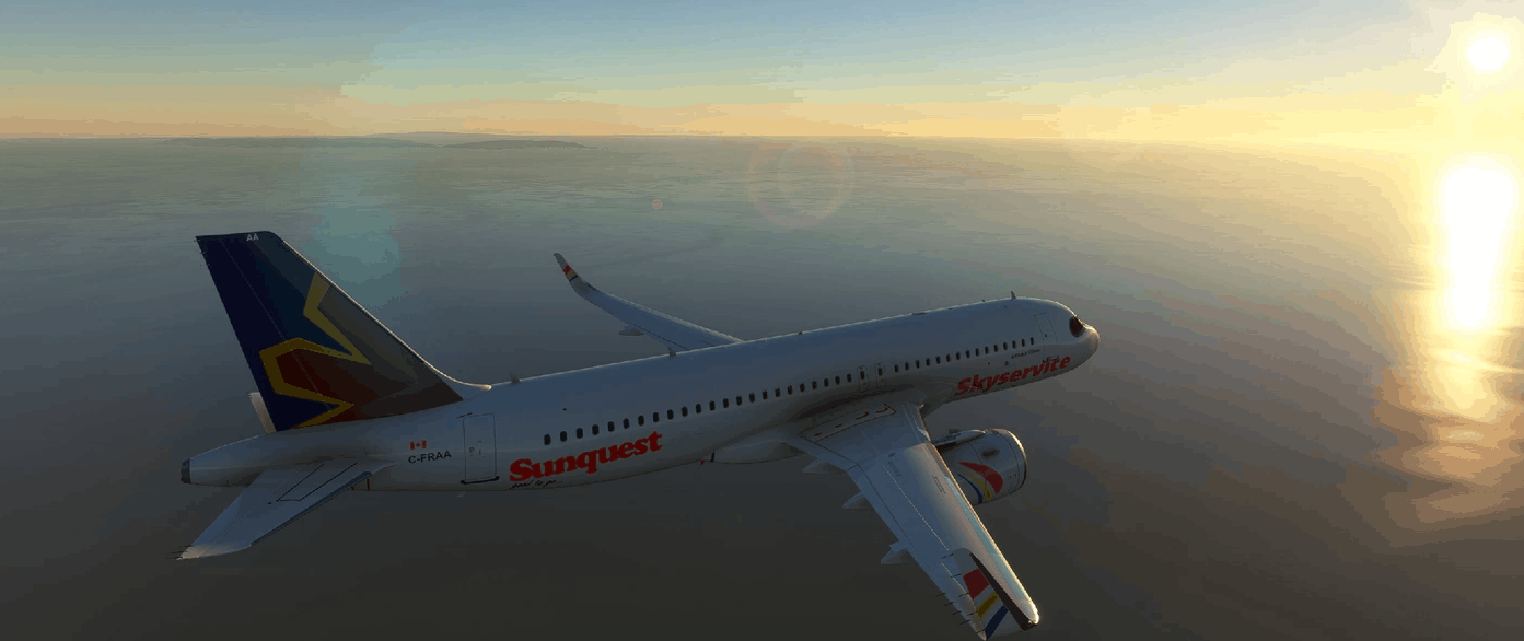
A320Neo Skyservice Pack -8K v1.0
Skyservice Airlines Inc. was a charter airline (Skyservice Airlines) based in the Etobicoke area of Toronto, Ontario, Canada. flew within Canada and to the U.S., Caribbean, Mexico, Israel, and Europe. Skyservice offered online-booking for those who wished to travel to Skyservice’s scheduled destinations in the summer. Skyservice Airlines began operations in 1994. Skyservice was forced into receivership on March 31, 2010, as a result of a near $9 million debt to its long-term partner Sunquest Vacations. As a result, Skyservice abruptly ceased operations. Please leave your comment and 5 STARS here, I really appreciate your support of my page. NOTE: Removed 3 liveries from my page and merge them into a pack since it’s the same airline but variety logo respective. 1.0 Repaint old airline Skyservice 8k Resolution Glossy Installation: To Install the livery, simply drag and drop to the community folder. MSFS 2020 Liveries 18 Mar, 2021 MSFS 2020 Liveries 16 Nov, 2020 MSFS 2020 Liveries 25 Nov, 2020
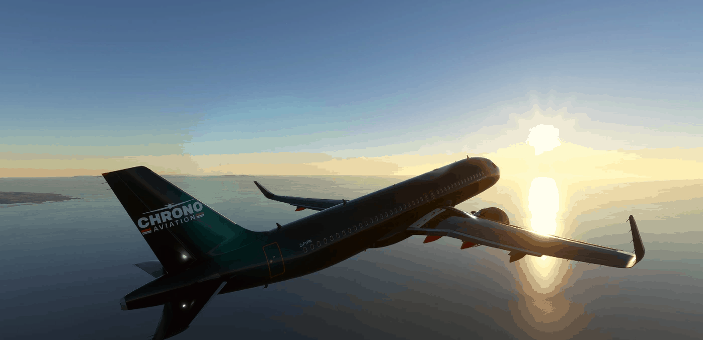
A320Neo Chrono Aviation -8K v1.0
Chrono Aviation Inc., and its wholly-owned subsidiary Chrono Jet Inc., is a charter airline headquartered at the Québec City Jean Lesage International Airport. It operates aircraft in passenger (9 to 120), cargo, and combi roles. It has bases at Montreal Saint-Hubert Longueuil Airport, Québec City Jean Lesage International Airport, and Rimouski Airport. In 2019, Chrono Aviation and Arctic Co-operatives Limited (ACL) Announced the awarding of a contract from Baffinland Iron Mines Corp for the provision of air transport services. Chrono Aviation will fly three to five flights a week from their base at Montréal Saint-Hubert Longueuil Airport. In October 2019, the company announced the groundbreaking of their 66,000 square foot hangar project being constructed at the Montréal Saint-Hubert Longueuil Airport which the ACL contract supported. Please leave your comment and 5 STARS here, I really appreciate your support of my page. 1.0 Repaint Chrono Aviation 8k Resolution Glossy Installation: To Install the livery, simply drag and drop to the community folder. MSFS 2020 Liveries 21 Nov, 2020 MSFS 2020 Liveries 9 Jul, 2021 MSFS 2020 Liveries 18 Nov, 2020
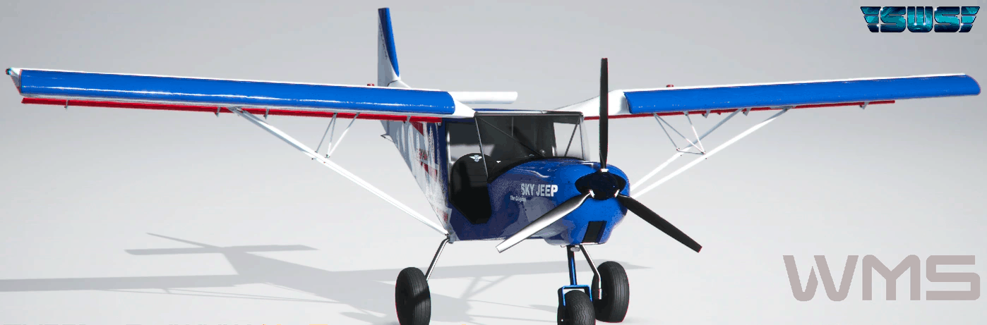
SWS-CH701-F-JWUW Repaint v1.0
French repaint for Zenith Aircraft CH701 developed by Simworks Studios (Payware) Installation : Unzip and copy content in your Community folder V1 : 2 Versions – Doors and No Doors MSFS 2020 Liveries 26 Sep, 2021 MSFS 2020 Liveries 13 Oct, 2022 MSFS 2020 Liveries 9 Apr, 2021
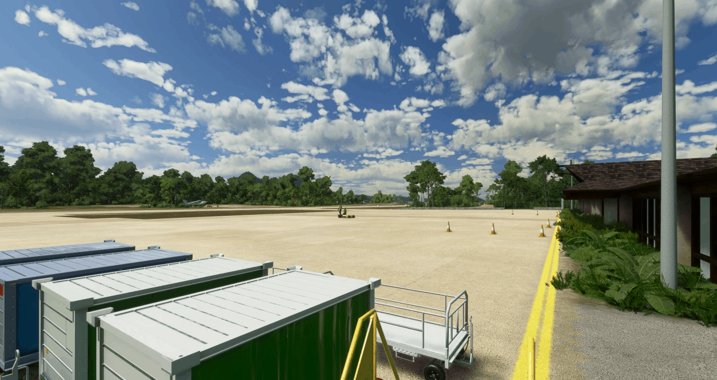
Lio Airport (El Nido) – RPEL* v1.0
After recently going to El-Nido for new years I decided to model the airport for all you guys! This will be my last (actual last) airport for an indefinite amount of time. Providing flights to El Nido as well as its many resorts, Lio Airport is owned by the airline AirSwift and has flights to and from Manila on ATR 42 and 72 aircraft. After flying there I can say that it has one of the most beautiful approaches allowing passengers to see the many islands and cliffs that are there. *DISCLAIMER* – Scenery is loosely based on images I took on my trip and current available information and may not be 100% accurate to the real life location. – There is a small easter egg to those who have amazingly keen eyes – It is RPEL in MSFS but RPEN IRL GPS Coordinates: 11.203227491771289, 119.41641408441485 MSFS 2020 Airports 4 Dec, 2020 MSFS 2020 Airports 13 Nov, 2020 MSFS 2020 Airports 23 Nov, 2020

AD Laguna Redonda (SCIO), Candelario Mancilla – Aysén v1.0
Introduction: Laguna Redonda Aerodrome is the southernmost air terminal in the Aysén Region in Chile, located approximately: 10 km south of the small settlement of Candelario Mancilla, 60 km southwest of Villa O’Higgins and 3 km north of the border with Argentina. It is also located in the middle of the Villa O’Higgins – El Chaltén tourist route, where more and more people cross from Chile to Argentina by land and water, crossing Lake O’Higgins (also known as San Martín) and the Laguna del Desierto, usually with the objective of reaching the foot of Mount Fitz Roy in Argentina. This aerodrome is located in the middle of a montainous and narrow valle, which is commonly accompained by strong crosswinds and low clouds, often being a challenge for landing and manouvering. Its runway (04/22) of dimensions 700m x 18m has a slight slope (2.1°) and is made of gravel, as well as the small parking spot that exists for 1 airplane. As markers, the track has small red and white barriers every 100 m approximately, in addition to the ocassional one in the vicinity that was blown away by the wind. It is an airport for day operations given the lack of lights of any kind. In MSFS, SCIO is part of the 10th and 11th leg of the Los Cerros to Cochrane Bush Trip. Description of the content: This is the first airport I have made in MSFS with SDK and it was the first one I did in FSX with ADE, so I am open to suggestions and constructive criticism for improvement. Included in Version 1.0: New runway closer to reality (made of gravel instead of asphalt and with dimensions according to satellite map and DGAC). In addition, the boundaries described in the introduction were added. A gravel parking space (apron) is also added, as well as a fence around the entire perimeter of the airfield. The two corresponding winsocks were added each to one end of the runway. The two default bridges that expanded over the Obstáculo River were removed given that they were too large and poorly located. They were replaced only by the new road segment that was added in the vicinity of the airport. The water was erased from one of the tributary streams of the Obstáculo River to the north of the runway as it was excessively wide and it distorted the forest. Water was added to a 122 Chilean and Argentinean lagoons/ponds and lakes not well represented originally in the vicinity of the aerodrome (including the mountain range) and edges of Lake O’Higgins. Forest was added to the west slope of the valley since it was missing more than half of it. Small tweaks in terms of land, boats and buildings in Calendario Mancilla and around the Laguna del Desierto. A yellow car was added near runway 04 as it was present in Bing Maps. Improvements to the Obstáculo River were made in the vicinity of the aerodrome, narrowing the channel and correcting the terrain and adjacent forest. GPS Coordinates: -48.933528, -72.800209 MSFS 2020 Airports 27 Dec, 2020 MSFS 2020 Airports 28 Oct, 2020 MSFS 2020 Airports 26 Mar, 2021
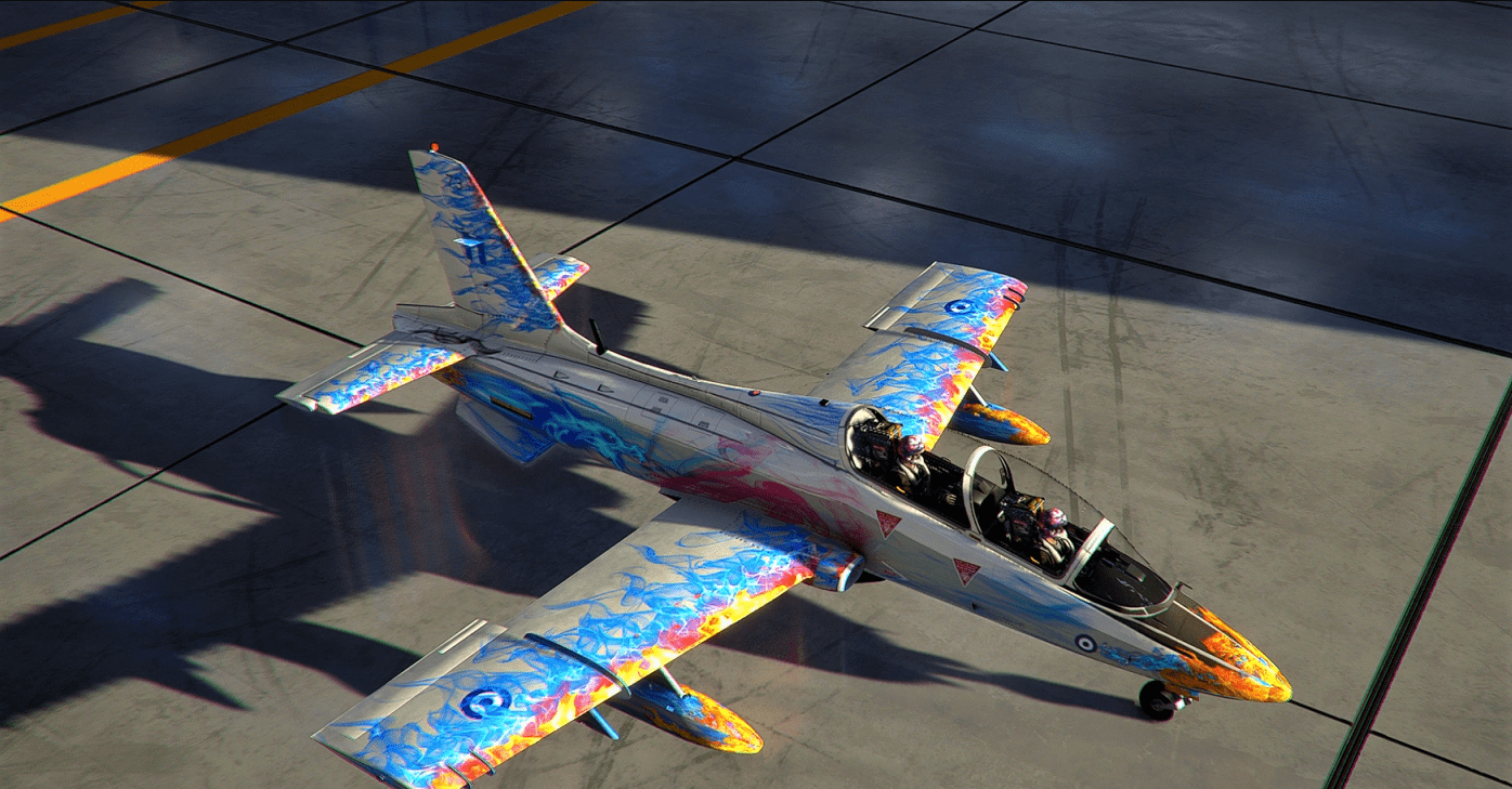
indiafoxtecho-mb339_Blue Dragon v1.0
This folder contains a repaint for the indiafoxtecho-MB-339 This is my first livery for msfs 2020,it took me many hours to fix it,i also repaint the pilott’s helmet. i would love to share it with you!! Reguirement To use this livery,you need the aircraft “Aermacchi MB-339” made by IndiaFoxtEcho Install Just unzip and drope the folder (indiafoxtecho-mb339_Blue Dragon) into your community folder. If you like my work,please do consider supporting me,it does helps for the time that i insest in doing this. Copyright:JiannisCamel MSFS 2020 Liveries 16 Jan, 2021 MSFS 2020 Liveries 9 Dec, 2020 MSFS 2020 Liveries 2 Jan, 2022
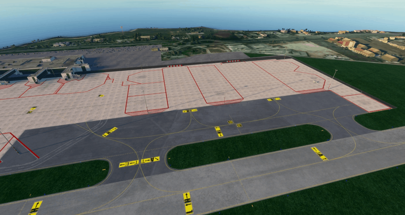
(Work in Progress) LICJ – Punta Raisi (PA) Progetto! V1.1
LICJ project Punta Raisi Airport (PA). I need your help, I’m looking for people who know how to use blender or maybe other conversion programs (Italian people). Please contact me privately so I can pass discord to you to speak. Finally I can say that the airport is 100% functional. There are many of the taxiway signs and parking numbers and many other things will be added in the coming days. This is the first version of the project, when other signals or maybe fix bags are implemented, the project will be loaded with a version of the project. Let me know either in private or in public if there are any problems in the airport. I hope you enjoy the first version. I also hope to receive your help. Thanks a lot FIX – Bag Fix – luci papi Fix – papi lights Fix – Marking pista 02-20 fix – Marking runway 02-20 fix – numerazione gate ramp Fix – numeration gate ramp MSFS 2020 Airports 15 May, 2021 MSFS 2020 Airports 23 Oct, 2020 MSFS 2020 Airports 13 May, 2021
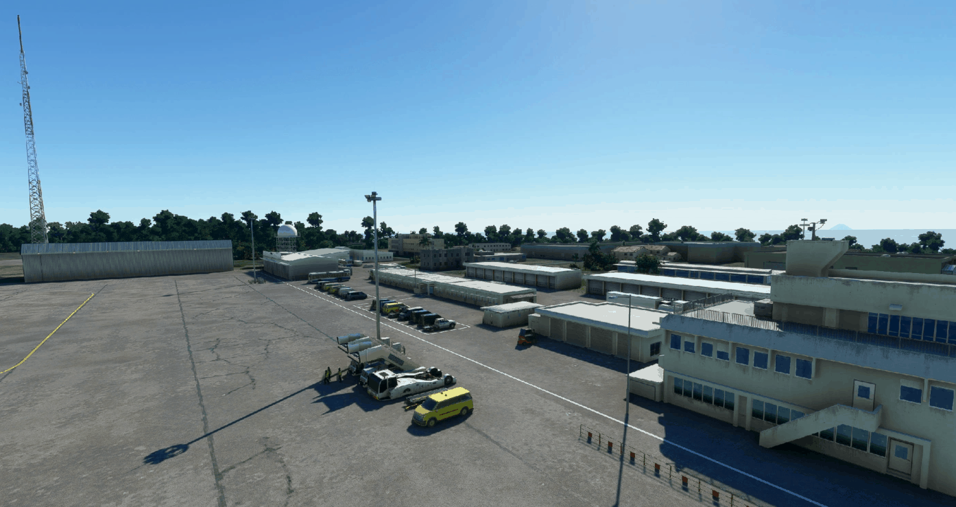
RJAW-Iwo Jima Air Base, Joint by USA and Japanese Self Defence Force (JSDF) v1.0
RJAW – Iwo Jima Air Base, Central Field Today Iwo Jima Air Base has around 350 Japanese Servicemen stationed, and are also used by the US Military as a Refueling Station, and for Special Pilot training. Access to the Island are restricted. This scenery has been created from scratch, because it was completely left out in MSFS. Now You will find all facilities like working ATC and on the main apron in Parking position P3-P4, you can call for groundservice, fueltruck etc. and you can refuel at the NE-Fuel Apron aswell. This scenery is created by the MSFS SDK and stock objects only. Check you dont have other RJAW vesions installed, then unzip and put the rjaw folder into your MSFS Community folder. Hope You will Enjoy Flying to Iwo Jima JP GPS Coordinates: 24.7828169,141.3107133 MSFS 2020 Airports 16 Nov, 2020 MSFS 2020 Airports 18 Apr, 2021 MSFS 2020 Airports 8 Nov, 2020
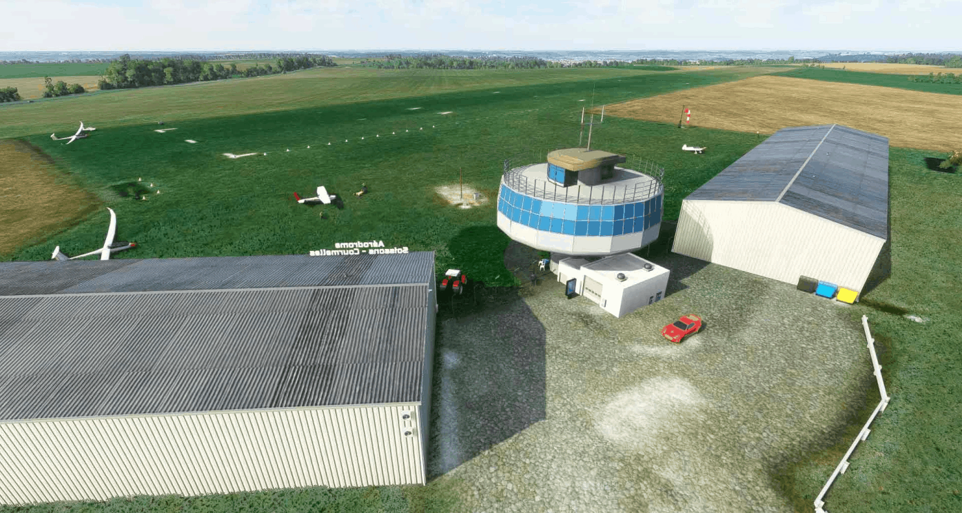
LFJS – Soissons – Courmelles v1.0
Soissons – Courmelles ICAO code: LFJS is a civil airport, open to public air traffic, located in the commune of Courmelles, 5 km southwest of Soissons in the Aisne department Hauts-de-France region You need 1 library : Mikea.at – AssetPack : https://www.allflightmods.com/microsoft-flight-simulator-2020/msfs2020-other/mikea-at-assetpack-v0-1-0/ GPS Coordinates: 49.34254086169135, 3.27763700391421 MSFS 2020 Airports 13 May, 2021 MSFS 2020 Airports 11 Jan, 2021 MSFS 2020 Airports 18 Oct, 2021
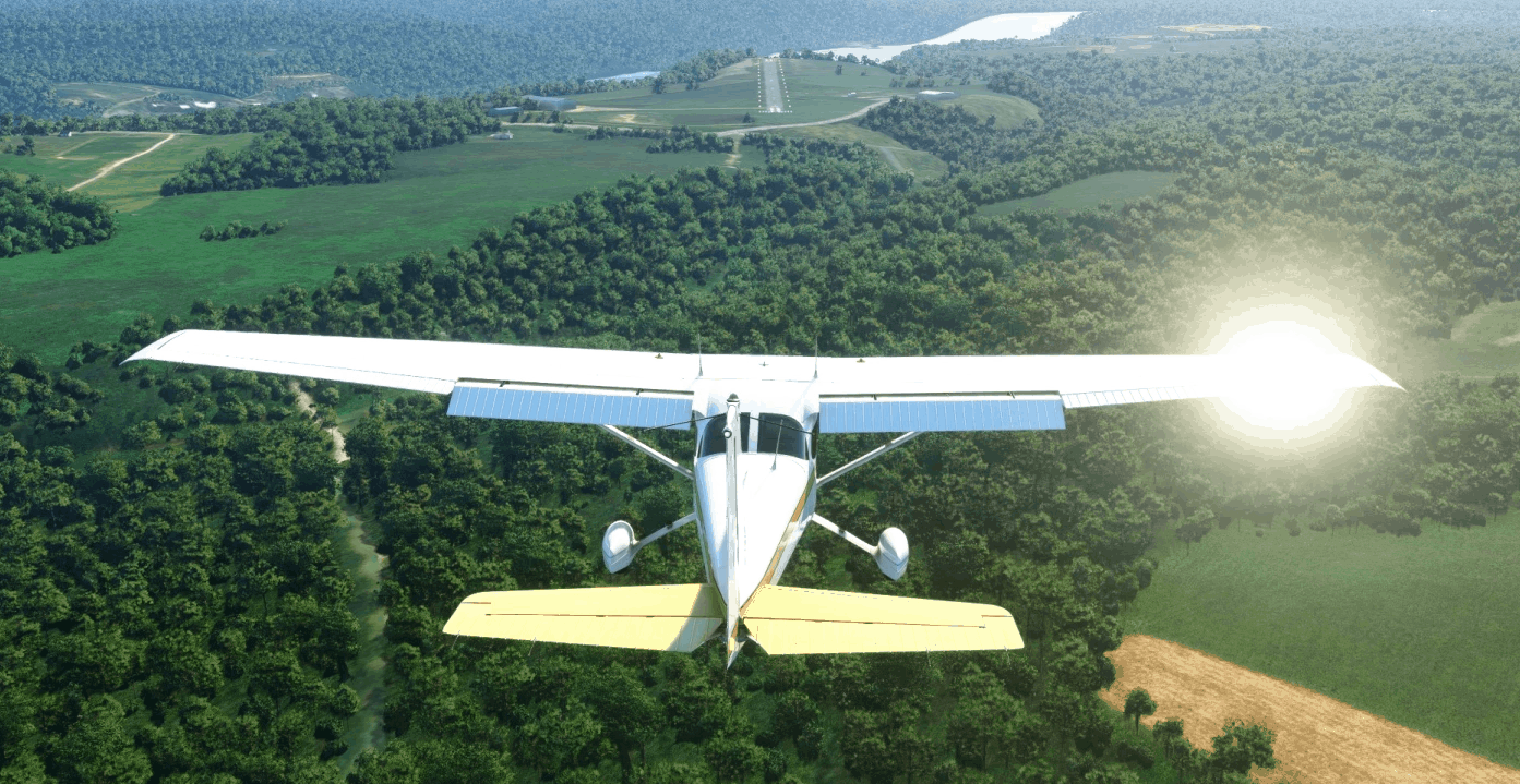
C172 G1000 – N806DX v1.0
My first livery, fictional N806DX. An interior will be added in a future update. Please leave me any feedback or suggestions! Drag and drop to the community folder. MSFS 2020 Liveries 15 Nov, 2020 MSFS 2020 Liveries 20 Jun, 2021 MSFS 2020 Liveries 3 Dec, 2021
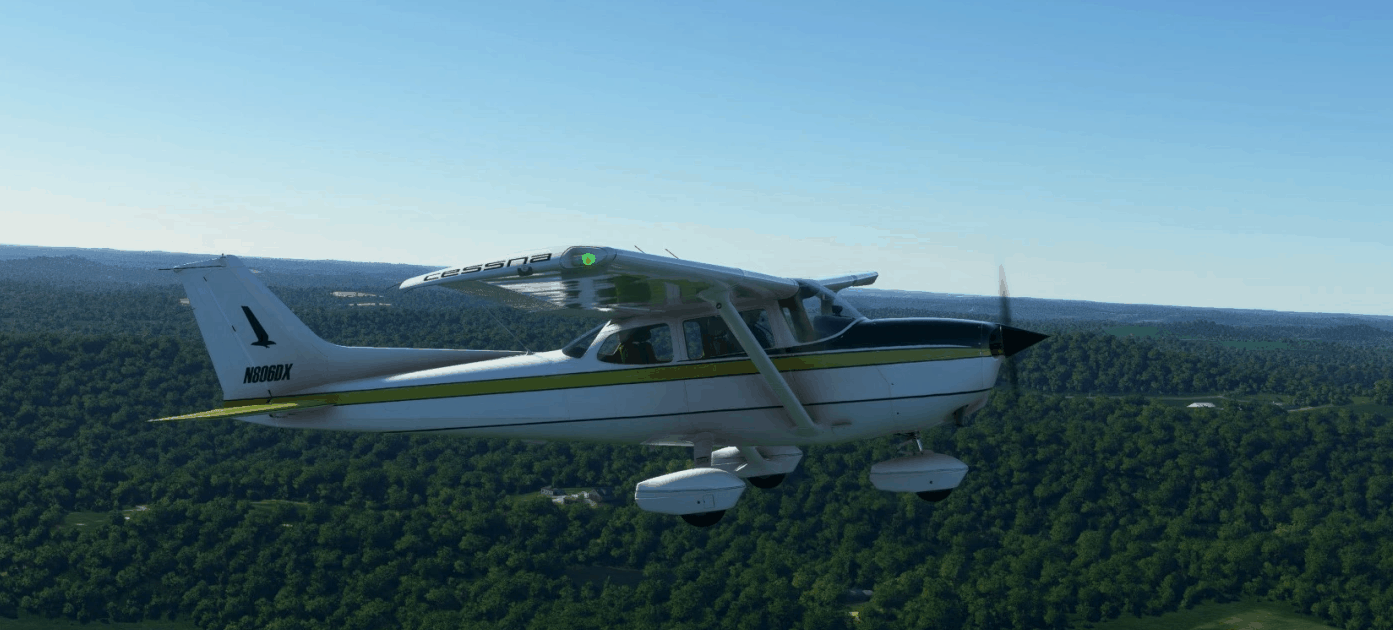
C172 Classic -N806DX v1.0
My first livery, fictional N806DX. An interior will be added in a future update. Please leave me any feedback or suggestions! Drag and drop to the community folder. MSFS 2020 Liveries 8 Nov, 2021 MSFS 2020 Liveries 25 Nov, 2021 MSFS 2020 Liveries 26 Mar, 2021
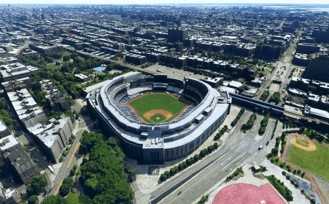
Yankee Stadium, Bronx New York NY USA v1.0
Updated scenery for Yankee Stadium in the Bronx NYC, home of the Yankees. Removed excess folliage. GPS Coordinates: 40.829587735332154, -73.92653576639 MSFS 2020 Scenery 16 Oct, 2020 MSFS 2020 Scenery 17 Sep, 2021 MSFS 2020 Scenery 12 Nov, 2020
- 15 per page
- 30 per page
- 45 per page
- 60 per page
-
See more per page
Bigger pages, fewer clicks - and no ads anywhere.
Go Pro