Microsoft Flight Simulator mods
109,300 results- 15 per page
- 30 per page
- 45 per page
- 60 per page
-
See more per page
Bigger pages, fewer clicks - and no ads anywhere.
Go Pro
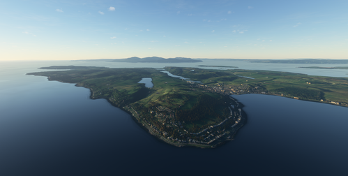
Argyll paddle steamers flight plans
Explore five 19th-century paddle steamer routes around Argyll and Bute in western Scotland with this add-on. Each route covers an average of around 50 miles and includes stops at various historical locations. The flight plans are available in Little Navmap format, offering a unique flying experience through beautiful Scottish landscapes.
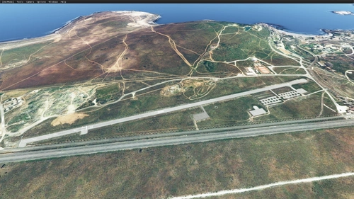
Quebrada Las Tacas, AD Las Tacas SCQT
Experience a private airfield at Quebrada Las Tacas, Chile with SCQT ICAO designation. Featuring a 1094 x 20 asphalt runway at an elevation of 46m (140ft), this enhanced scenery add-on is built using default MSFS SDK objects. Simply decompress and install in your Flight Simulator "Community" folder to enjoy this unique location just 20 km south of La Serena.
![Northern Alps Bush Trip [FlightPlan]](https://cdn.flightsim.to/images/08/VsHFo5py.jpg?width=500)
Northern Alps Bush Trip [FlightPlan]
Explore the stunning Northern Alps region with this corresponding Flight Plan File for the immersive Bush Trip experience. Fly through picturesque landscapes and challenging terrains as you navigate your way through this exciting aviation journey.
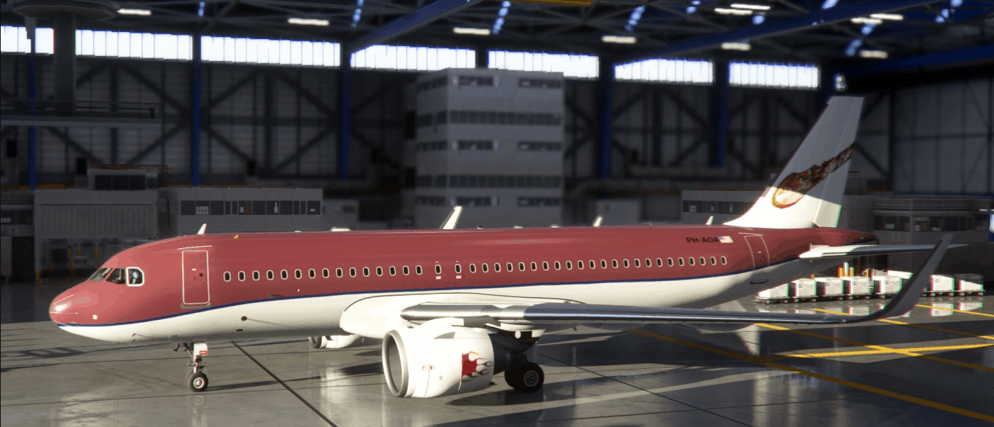
A320_NEO_Meteor v1.0
Meteor Airlines, Shooting Star Alines, red with meteor tail. Install in community folder. Feel free to repaint. Thank you. MSFS 2020 Liveries 29 Sep, 2021 MSFS 2020 Liveries 29 Oct, 2022 MSFS 2020 Liveries 24 Aug, 2022
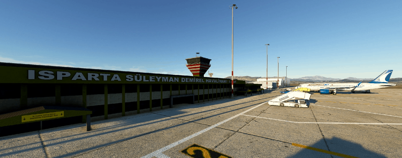
LTFC Suleyman Demirel Airport, Isparta, Turkey v0.1.0
This scenery is a combined effort using some XP11 objects by Kamil Uzun and a couple of new objects by M. Ali Oguducu, infrastructure and object placements arranged by myself. Actually there are 2 sceneries in this package, one being the subject airport (LTFC) and an adjacent one (LTFN Kilic) which is a military pilot training facility. Stock scenery for both airports are affecting one another and the terrain seems to be too bumpy for an airport so we decided to share both in one package to avoid elevation conflicts. There are much more buildings in reality in the military facility but it was not our intention to simulate that so we just used what was available from our previous work. We do not think there will be future updates but you never know. Simply extract both packages in your community folder and start up MSFS. You should be good to go. Enjoy. MSFS 2020 Airports 30 Nov, 2020 MSFS 2020 Airports 25 Oct, 2020 MSFS 2020 Airports 1 Jan, 2021
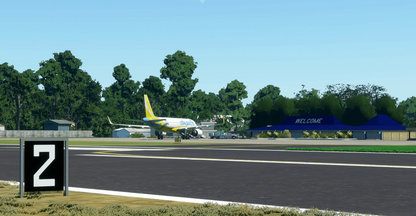
Labo Airport (Ozamiz) – RPMO v1.0
Labo Airport, also known as Ozamiz Airport, is an airport serving the general area of the city of Ozamiz in the Philippines. It is the only airport in the province of Misamis Occidental. The airport is classified as a community airport by the Civil Aviation Authority of the Philippines, a body of the Department of Transportation that is responsible for the operations of not only this airport but also of all other airports in the Philippines except the major international airports. It is one of only two community airports in the Philippines with commercial operations, but one of the busiest in Mindanao in terms of aircraft movement and passenger traffic.The airport takes its name from its location, barangay Labo in Ozamiz City.Ozamiz Airport also serves the cities of Oroquieta and Tangub, some municipalities of Zamboanga del Sur, Lanao del Norte and some parts of Lanao del Sur. The airport is currently serving flights from Manila and Cebu (Philippine Airlines and Cebu Pacific) U-TURNS ARE NOW AVAILABLE AS AN OPTIONAL CHOICE! Disclaimer: – The airport is not 100% accurate compared to the actual GPS Coordinates: 8.178525, 123.841386 MSFS 2020 Airports 16 Nov, 2020 MSFS 2020 Airports 28 Sep, 2020 MSFS 2020 Airports 3 Nov, 2021
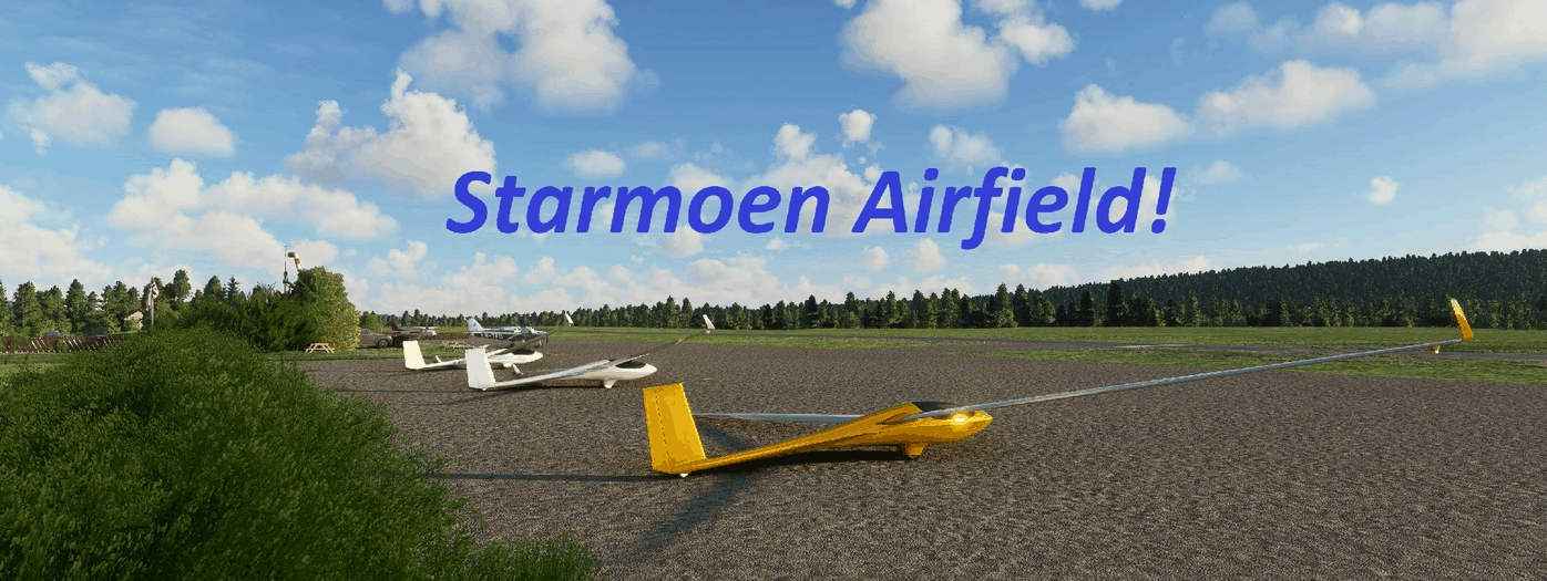
Starmoen Flyplass ENSM v1.0
Welcome to Starmoen Airfield! (ENSM) Starmoen Airfield is the national centre for sailplanes / gliders in Norway and is used by many different aviation enthusiasts. Starmoen hosts many different competitions. Beside competition in gliding, they also have model plane activities with their own runway just to the east of the airfield. They even got their own RC car arena. The Airfield is located North East of Oslo Gardermoen international airport (ENGM), about 30-40 min of flight time. If you want to fly a short trip from Starmoen, I can recommend Trysil Airport (ENTS) or Hamar Airport (ENHA) as well. I hope you like the scenery, most of the models are made in Blender. Let me know if there are any issues. Updates will come. Fly safe, thanks. GPS Coordinates: 60.87721080654842, 11.67490967109487 MSFS 2020 Airports 6 Dec, 2020 MSFS 2020 Airports 1 Oct, 2021 MSFS 2020 Airports 1 Feb, 2021

Segelflugplatz Bad Marienberg Lite V1.0
Glider airfield Bad Marienberg V1.0 – Microsoft Flight Simulator The gilder airfield Bad Marienberg inside the west wood forest is located near the towns of Hof and Oberrossbach. The runway has a height difference from about 20m. A take off in direction 11 is not easy in difficult wind conditions. Scenery Information: Airfield close to the real one Flatten at the Hangar area sloped runway after geo data static Aircrafts 3 parking position Fuel station Airfield Data: Elevation: 527m / 1729ft MSL 1000m grass runway Direction 11 / 29 Pattern 2500ft north & south Frequency: 120.085 MHz Installation: Please copy the scenery folder “zulugolfalpha-bad marienberg” into your Community folder. MSFS 2020 Airports 3 Feb, 2021 MSFS 2020 Airports 16 Apr, 2021 MSFS 2020 Airports 11 Dec, 2020
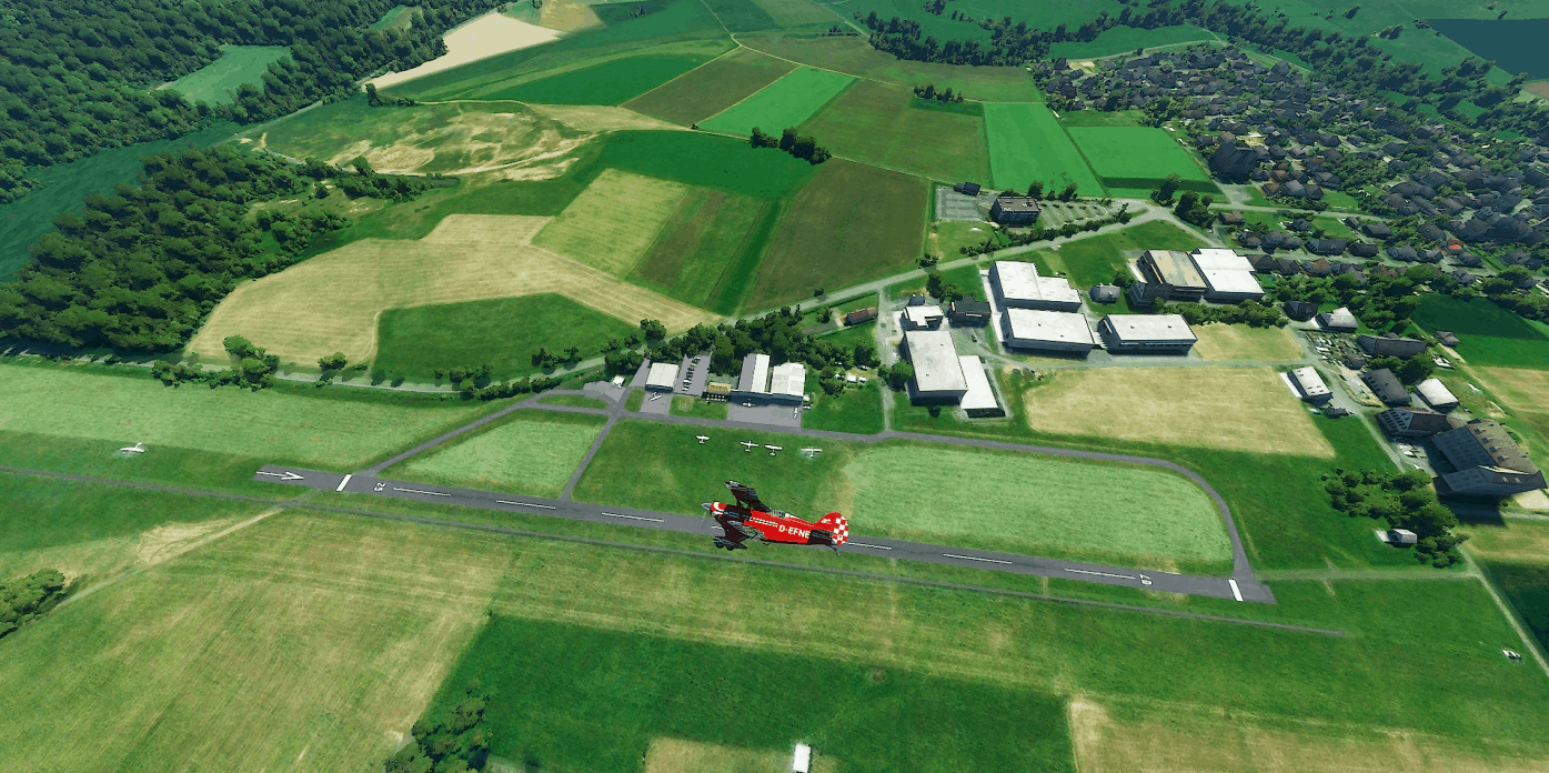
EDRW Dierdorf-Wienau Lite V1.1
EDRW – Dierdorf-Wienau Lite V1.1 – Microsoft Flight Simulator The airfield Dierdorf-Wienau – EDRW is located in the norther Rhineland-Palatinate next to the motorway A3. The special airfield has a 580m x 10m asphalt runway, which was also tested by the famous Ludolf brothers with their cars. Scenery Information: Airfield close to the real one Elevation Data with Terraforming displaced threshold 4 parking positions static Aircrafts Airfield Data: Elevation: 290m / 951ft MSL 580m x 10m asphalt runway Direction 07 / 25 Pattern 1800ft north & south Frequency: 128.930 MHz Installation: Please copy the scenery folder “zulugolfalpha-edrw” into your Community folder. Update V1.1 : – Adjusted vegetation – Add taxiway path to parking position MSFS 2020 Airports 6 Nov, 2021 MSFS 2020 Airports 26 Dec, 2020 MSFS 2020 Airports 26 May, 2021
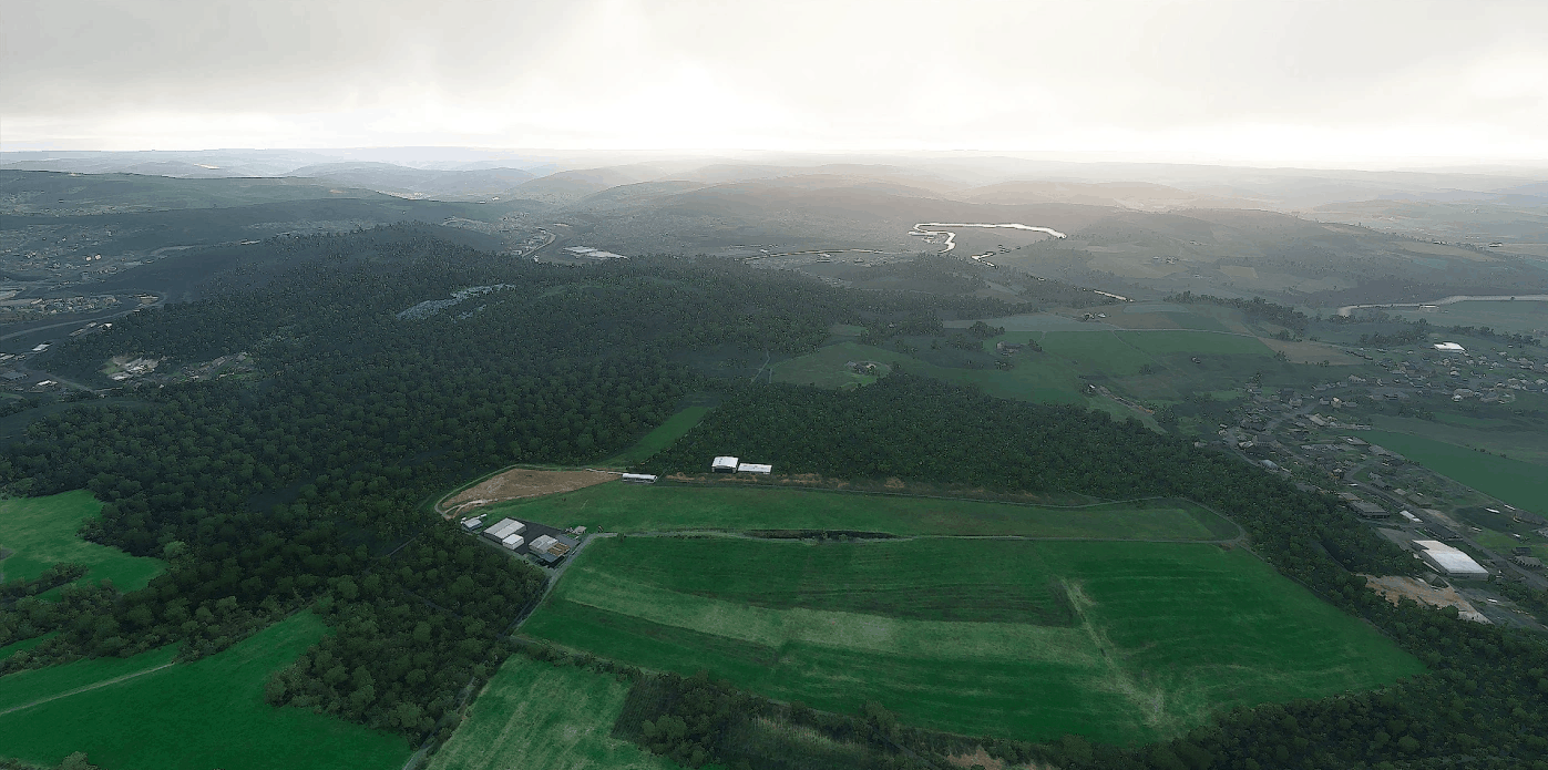
EDKI – Betzdorf-Kirchen (lite) V1.0
Flugi’s Bastelstube EDKI – Betzdorf-Kirchen Lite V1.0 – Microsoft Flight Simulator The airfield Betzdorf-Kirchen – EDKI is located in the northern tip of the Rhineland-Palatinate close to the Siegerland. The airfield has a 500m x 30m grass runway with a slight slop. The airfield is located near the district Katzwinkel and Wingendorf. Scenery Information: Airfield close to the real one Flatten at the Hangar area sloped runway after airfield chart static Aircrafts signal box Airfield Data: Elevation: 340m / 1126ft MSL 500m x 30m grass runway Direction 08 / 26 Pattern 1900ft south Frequency: 122.230 MHz Installation: Please copy the scenery folder “zulugolfalpha-edki” into your Community folder. GPS Coordinates: 50°49’02.8″N 7°49’53.5″E MSFS 2020 Airports 17 May, 2021 MSFS 2020 Airports 5 Nov, 2020 MSFS 2020 Airports 10 Oct, 2020
EDFY – Flugplatz Elz (lite) V1.1
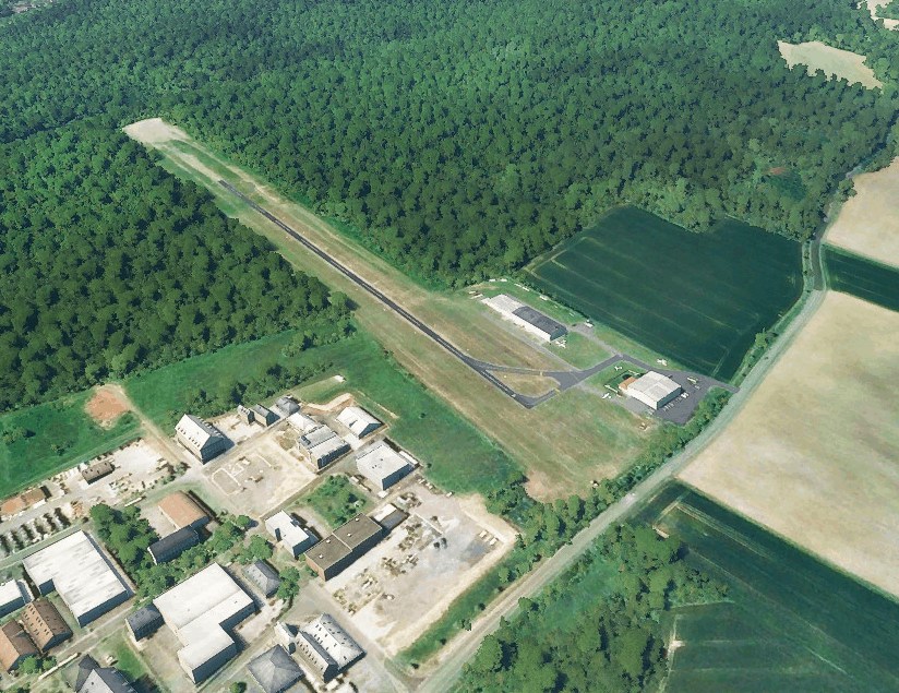
EDFY – Elz Lite V1.1 – Microsoft Flight Simulator The airfield Elz EDFY is located 3.5NM north of the city Limburg close to the state border between Hessen and Rhineland-Palatinate. The special airfield has a 750m x 20m grass runway with a 580m x 6m asphalt strip. Scenery Information: Airfield close to the real one Flatten at the Hangar area sloped runway after airfield chart static Aircrafts Airfield Data: Elevation: 213m / 699ft MSL 750m x 20m grass runway Direction 07 / 25 Pattern 1400ft north Frequency: 128.775 MHz Installation: Please copy the scenery folder “zulugolfalpha-edfy“ into your Community folder. Update Note: V1.1: – Added airfield frequency – Added missing windmill near Autobahn – Removed second windsock – Add magnetic variation GPS Coordinates: 50°25’42.5″N 8°00’54.4″E MSFS 2020 Airports 6 Sep, 2021 MSFS 2020 Airports 9 Jan, 2021 MSFS 2020 Airports 7 Jul, 2021
Coventry City Remake
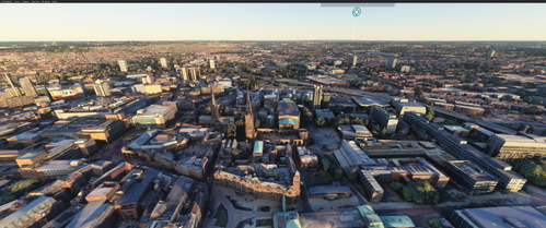
Explore a detailed remake of Coventry City in the UK with this add-on for Microsoft Flight Simulator.
EDGA – Ailertchen (lite) v1.1
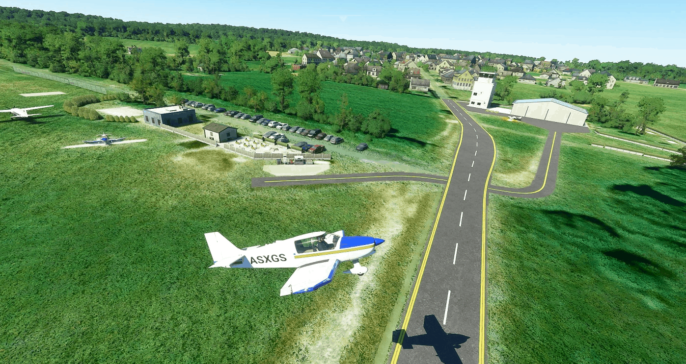
EDGA – Ailertchen Lite V1.1 – Microsoft Flight Simulator The airfield Ailertchen EDGA is located inside the Westwood forest between Cologne and Frankfurt/Main. Next to gliding and piston aircraft flying there are also parachuting activities on this airfield. This Scenery was created only with the MSFS SDK. It contains no other objects. Scenery Information: Airfield close to the real one Flatten at the Hangar and Visitors’ area Slightly sloped runway Special: Taxiway crosses main road static Aircrafts DR400, VL3, Grad Caravan Airfield Data: Elevation: 470m / 1540ft MSL 550m x 40m grass runway Direction 03 / 21 Pattern 2300ft NW Frequency: 126.410 MHz Update Note: V1.1: Added airfield frequency Added fuel station working with MSFS Added taxiway Added magnetic variation GPS Coordinates: 50°35’34.5″N 7°56’41.8″E MSFS 2020 Airports 2 Sep, 2021 MSFS 2020 Airports 2 Sep, 2021 MSFS 2020 Airports 19 Oct, 2020
CYOW Macdonald-Cartier
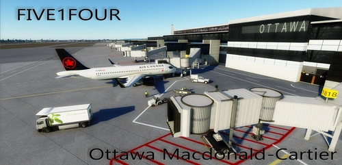
Enhance your Microsoft Flight Simulator experience with the CYOW Macdonald-Cartier Ottawa add-on. Version 1.1 features a meticulously crafted model created with Blender and textures designed using Photoshop. Explore this detailed airport scenery and show your support to the creators. Follow their progress on Facebook and consider donating to further their development efforts.

First Officer Audio of A320neo Checklist for Air Tool
Enhance your A320neo checklist experience with this add-on featuring authentic First Officer callout audio, spoken by a Japanese pilot. Easily install the audio files into your Air Tool for a more immersive flight deck experience. Simply follow the steps provided and enjoy the realistic audio enhancements during your flights.
- 15 per page
- 30 per page
- 45 per page
- 60 per page
-
See more per page
Bigger pages, fewer clicks - and no ads anywhere.
Go Pro