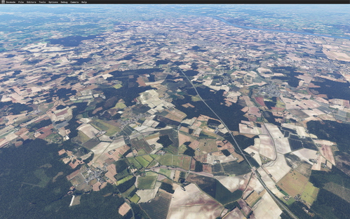
LFJR - ANGERS/Marcé - Aerial 1M - East Maine-et-Loire - 01
Enhance your flying experience with LFJR - ANGERS/Marcé - Aerial 1M - East Maine-et-Loire - 01. This add-on offers high-quality 1-meter resolution aerial scenery for the eastern part of the Maine-et-Loire department, addressing the BingMap texture shift issue. The package includes removal of auto-generated houses, replacement of native vegetation with polygons from the TOPO® OpenData IGN database, and colorometric correction for seamless integration with ANGERS City update II. Compatible with LFJR - ANGERS/Marcé - Airport, this add-on is a collaborative effort involving Microsoft Asobo, Arno Gerretsen, and MSFS Toolkit by Nool Aerosystems. Enjoy this meticulously crafted scenery for Microsoft Flight Simulator, available for free distribution with the authors permission.
Download Links
Report a problem
LFJR - ANGERS/Marcé - Aerial 1M - East Maine-et-Loire - 01
Advertisement
Remove ads