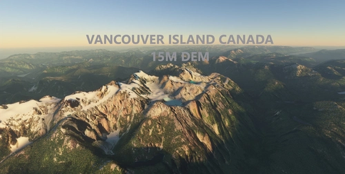
Vancouver Island, Canada, 15m DEM - High Resolution Terrain Elevation Data from LIDAR Imaging
Explore Vancouver Island in detail with this mod featuring high resolution LIDAR DEM data at a 15m mesh resolution. Experience accurate mountain shapes, flattened lakes, and rivers, with terrain artifacts removed. Choose between different download options for the northern, southern, or entire island for an improved scenery experience. Enhance your VFR flights above Vancouver Island with this detailed and realistic terrain elevation data.
Download Links
Report a problem
Vancouver Island, Canada, 15m DEM - High Resolution Terrain Elevation Data from LIDAR Imaging
Advertisement
Remove ads