SnapTrack - Automatic GPS Geotagging for MSFS Screenshots
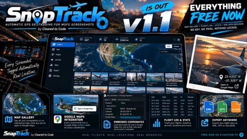
SnapTrack is a free Windows tray app for Microsoft Flight Simulator 2020 and 2024 that automatically geotags your screenshots. It writes GPS coordinates (as standard EXIF/XMP and as readable text with a Google Maps link), altitude, heading, speed, aircraft, nearest airport and weather into each image, losslessly and offline. Works with Photo Mode, Game Bar, Steam, NVIDIA and ShareX. Includes a local dashboard with Open in Google Maps, a map gallery of flight tracks, a flight log with statistics and KML/GPX/GeoJSON export. No account, no key.
Download Links
Report a problem
SnapTrack - Automatic GPS Geotagging for MSFS Screenshots
Advertisement
Remove ads